Pict. [Mapporn] Open and closed borders of the world according to Wikipedia [OC] [2005x985] (#World #Wikipedia #Closed #Borders)Pict. 2005×985 px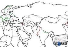 Pict. [Mapporn] Historical borders of Texas [5100x6600] (#Texas #Historical #Borders)Pict. 5100×6600 px
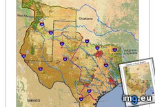 Pict. [Mapporn] Ethnographical map of the Kingdom of Hungary with post Treaty of Trianon borders shown [4962x3509] (#Map #Kingdom #Borders #Hungary #Shown)Pict. 4962×3509 px
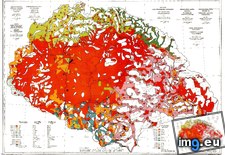 Pict. [Mapporn] USA State Borders: Rivers and Lakes [2500x1875] (#State #Usa #Lakes #Borders #Rivers)Pict. 2500×1875 px
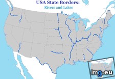 Pict. [Mapporn] The fragmented border of India and Bangladesh - Earlier this week the two countries agreed to simplify their borders b (#Two #Week #Countries #Bangladesh #Agreed)Pict. 1100×2148 px
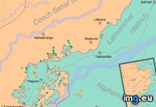 Pict. [Mapporn] Map with proposed borders of Czechoslovkia (around 1919) [4724x2525] (#Map #Borders #Proposed)Pict. 4724×2525 px
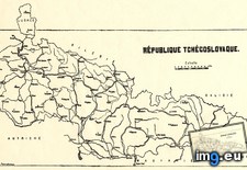 Pict. [Mapporn] The Proposed Borders of The Republic of New Afrika [1024x646] (#Republic #Borders #Proposed #1024x646 #Afrika)Pict. 1024×646 px
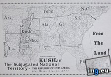
★ 5168 pkt. ♥ 0 gefällt ⬇ 5 gespeichert
Pict. [Mapporn] Historical borders of Texas [5100x6600] (#Texas #Historical #Borders)Pict. 5100×6600 px★ 5208 pkt. ♥ 0 gefällt ⬇ 7 gespeichert
Pict. [Mapporn] Ethnographical map of the Kingdom of Hungary with post Treaty of Trianon borders shown [4962x3509] (#Map #Kingdom #Borders #Hungary #Shown)Pict. 4962×3509 px★ 5162 pkt. ♥ 0 gefällt ⬇ 2 gespeichert
Pict. [Mapporn] USA State Borders: Rivers and Lakes [2500x1875] (#State #Usa #Lakes #Borders #Rivers)Pict. 2500×1875 px★ 5309 pkt. ♥ 0 gefällt ⬇ 8 gespeichert
Pict. [Mapporn] The fragmented border of India and Bangladesh - Earlier this week the two countries agreed to simplify their borders b (#Two #Week #Countries #Bangladesh #Agreed)Pict. 1100×2148 px★ 6587 pkt. ♥ 0 gefällt ⬇ 6 gespeichert
Pict. [Mapporn] Map with proposed borders of Czechoslovkia (around 1919) [4724x2525] (#Map #Borders #Proposed)Pict. 4724×2525 px★ 4537 pkt. ♥ 0 gefällt ⬇ 2 gespeichert
Pict. [Mapporn] The Proposed Borders of The Republic of New Afrika [1024x646] (#Republic #Borders #Proposed #1024x646 #Afrika)Pict. 1024×646 px★ 5720 pkt. ♥ 0 gefällt ⬇ 5 gespeichert