★ 4306 pkt. ♥ 0 gefällt ⬇ 3 gespeichert
![[Mapporn] Google Maps lets you play PacMan anywhere. [1,015x609] (#Play #Google #Maps) - 85 KB Tags: google, maps, play (Pict. in My r/MAPS favs)](https://t.im9.eu/mapporn-google-maps-lets-you-play-pacman-anywhere-1-015x609.jpg) Pict. [Mapporn] We've all seen maps of landlocked countries...here's a map of landlocked first level administrative divisions [4972x25 (#Map #Countries #Divisions #Administrative #Landlocked)Pict. 4972×2517 px
Pict. [Mapporn] We've all seen maps of landlocked countries...here's a map of landlocked first level administrative divisions [4972x25 (#Map #Countries #Divisions #Administrative #Landlocked)Pict. 4972×2517 px★ 7111 pkt. ♥ 0 gefällt ⬇ 10 gespeichert
![[Mapporn] We've all seen maps of landlocked countries...here's a map of landlocked first level administrative divisions [4972x25 (#Map #Countries #Divisions #Administrative #Landlocked) - 261 KB Tags: administrative, countries, divisions, landlocked, level, map, maps (Pict. in My r/MAPS favs)](https://t.im9.eu/mapporn-we-ve-all-seen-maps-of-landlocked-countries-here-s-a-map-of-landlocked-first-level-administrative-divisions-4972x2517.jpg) Pict. maps-and-keys-chart (#Maps #Chart #Keys)Pict. 603×735 px
Pict. maps-and-keys-chart (#Maps #Chart #Keys)Pict. 603×735 px★ 1826 pkt. ♥ 0 gefällt ⬇ 9 gespeichert
 Pict. [Mapporn] Border Uncertainties: 1920 Map Published During Polish-Soviet War and Before Signing of Trianon Treaty (More maps in c (#Map #Polish #Soviet #Published #Signing)Pict. 3984×2241 px
★ 6256 pkt. ♥ 0 gefällt ⬇ 8 gespeichert
![[Mapporn] Border Uncertainties: 1920 Map Published During Polish-Soviet War and Before Signing of Trianon Treaty (More maps in c (#Map #Polish #Soviet #Published #Signing) - 1.2 MB Tags: map, maps, polish, published, signing, soviet, war (Pict. in My r/MAPS favs)](https://t.im9.eu/mapporn-border-uncertainties-1920-map-published-during-polish-soviet-war-and-before-signing-of-trianon-treaty-more-maps-in-comments-3984x2241.jpg) Pict. [Mapporn] Stylized empire maps from the game Civilization V (full album in comments)[347x403] (#Album #Game #Empire #Civilization #Stylized)Pict. 347×403 px
Pict. [Mapporn] Stylized empire maps from the game Civilization V (full album in comments)[347x403] (#Album #Game #Empire #Civilization #Stylized)Pict. 347×403 px★ 6419 pkt. ♥ 0 gefällt ⬇ 7 gespeichert
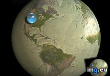
![[Mapporn] Stylized empire maps from the game Civilization V (full album in comments)[347x403] (#Album #Game #Empire #Civilization #Stylized) - 47 KB Tags: album, civilization, empire, full, game, maps, stylized (Pict. in My r/MAPS favs)](https://t.im9.eu/mapporn-stylized-empire-maps-from-the-game-civilization-v-full-album-in-comments-347x403.jpg) Pict. mapporn-all-the-water-on-earth-presented-as-a-sphere-it-would-have-a-diameter-of-about-860-miles-and-a-volume-around-332-500-000-cubic-miles-1600-1534 (#World #White #Map #Best #Europe #Water #Miles #Geography #Statistics #Presented #Diameter #Sphere #Cubic)Pict. 950×911 px
Pict. mapporn-all-the-water-on-earth-presented-as-a-sphere-it-would-have-a-diameter-of-about-860-miles-and-a-volume-around-332-500-000-cubic-miles-1600-1534 (#World #White #Map #Best #Europe #Water #Miles #Geography #Statistics #Presented #Diameter #Sphere #Cubic)Pict. 950×911 px★ 10k pkt. ♥ 0 gefällt ⬇ 5 gespeichert
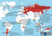
 Pict. mapporn-some-of-the-most-hazardous-places-in-the-world-838-612 (#World #Map #Wide #Usa #Asia #Geography #Statistics)Pict. 838×612 px
★ 7644 pkt. ♥ 0 gefällt ⬇ 4 gespeichert
 Pict. [Mapporn] Facebook data maps which baseball teams are most popular in each US county [959x551] (#Facebook #County #Popular #Teams #959x551)Pict. 959×551 px
★ 6582 pkt. ♥ 0 gefällt ⬇ 6 gespeichert
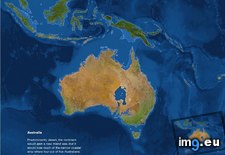
![[Mapporn] Facebook data maps which baseball teams are most popular in each US county [959x551] (#Facebook #County #Popular #Teams #959x551) - 102 KB Tags: 959x551, baseball, county, data, facebook, maps, popular, teams (Pict. in My r/MAPS favs)](https://t.im9.eu/mapporn-facebook-data-maps-which-baseball-teams-are-most-popular-in-each-us-county-959x551.jpg) Pict. mapporn-what-australia-and-surrounding-territories-would-look-like-if-all-the-ice-on-earth-were-to-melt-australia-1-024px-766px (#White #Map #Best #Wide #Europe #Ice #Asia #Territories #Melt #Stats #Surrounding #Statistics)Pict. 1024×766 px
Pict. mapporn-what-australia-and-surrounding-territories-would-look-like-if-all-the-ice-on-earth-were-to-melt-australia-1-024px-766px (#White #Map #Best #Wide #Europe #Ice #Asia #Territories #Melt #Stats #Surrounding #Statistics)Pict. 1024×766 px★ 9960 pkt. ♥ 0 gefällt ⬇ 8 gespeichert
 Pict. [Mapporn] Since the UK and France stereotype maps were so popular I thought I'd do my home. Stereotypes of Canada from a Nova S (#Thought #Canada #France #Stereotypes #Stereotype)Pict. 2099×1845 px
★ 6684 pkt. ♥ 0 gefällt ⬇ 2 gespeichert
![[Mapporn] Since the UK and France stereotype maps were so popular I thought I'd do my home. Stereotypes of Canada from a Nova S (#Thought #Canada #France #Stereotypes #Stereotype) - 375 KB Tags: canada, france, maps, nova, popular, stereotype, stereotypes, thought (Pict. in My r/MAPS favs)](https://t.im9.eu/mapporn-since-the-uk-and-france-stereotype-maps-were-so-popular-i-thought-i-d-do-my-home-stereotypes-of-canada-from-a-nova-scotian-who-lives-in-the-nwt-2099x1845.jpg) Pict. [Mapporn] Maps from the official MH17 crash investigation [1125x2536] (#Maps #Official #Crash #Mh17)Pict. 1124×2536 px
Pict. [Mapporn] Maps from the official MH17 crash investigation [1125x2536] (#Maps #Official #Crash #Mh17)Pict. 1124×2536 px★ 5231 pkt. ♥ 0 gefällt ⬇ 8 gespeichert
![[Mapporn] Maps from the official MH17 crash investigation [1125x2536] (#Maps #Official #Crash #Mh17) - 456 KB Tags: crash, maps, mh17, official (Pict. in My r/MAPS favs)](https://t.im9.eu/mapporn-maps-from-the-official-mh17-crash-investigation-1125x2536.jpg) Pict. mapporn-the-island-of-madagascar-compared-to-alaska-543-524 (#World #White #Map #Wide #Europe #Maps #Asia #Compared #Geography #Stats #Madagascar)Pict. 543×524 px
Pict. mapporn-the-island-of-madagascar-compared-to-alaska-543-524 (#World #White #Map #Wide #Europe #Maps #Asia #Compared #Geography #Stats #Madagascar)Pict. 543×524 px★ 9116 pkt. ♥ 0 gefällt ⬇ 6 gespeichert
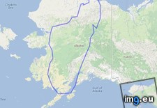 Pict. [Mapporn] Three Approaches to the U.S.: WW-II era tilted perspective maps from viewpoints above Berlin, Tokyo, and Caracas. [161 (#Maps #Tokyo #Berlin #Tilted #Caracas #Viewpoints)Pict. 1617×2074 px
★ 7374 pkt. ♥ 0 gefällt ⬇ 6 gespeichert
![[Mapporn] Three Approaches to the U.S.: WW-II era tilted perspective maps from viewpoints above Berlin, Tokyo, and Caracas. [161 (#Maps #Tokyo #Berlin #Tilted #Caracas #Viewpoints) - 604 KB Tags: approaches, berlin, caracas, era, maps, perspective, tilted, tokyo, viewpoints (Pict. in My r/MAPS favs)](https://t.im9.eu/mapporn-three-approaches-to-the-u-s-ww-ii-era-tilted-perspective-maps-from-viewpoints-above-berlin-tokyo-and-caracas-1617-2074.jpg) Pict. [Mapporn] Central Europe, as defined by overlaying multiple maps from different sources [OC][2000x1850] (#Europe #Maps #Sources #Defined #Overlaying)Pict. 2000×1695 px
Pict. [Mapporn] Central Europe, as defined by overlaying multiple maps from different sources [OC][2000x1850] (#Europe #Maps #Sources #Defined #Overlaying)Pict. 2000×1695 px★ 6811 pkt. ♥ 0 gefällt ⬇ 19 gespeichert
![[Mapporn] Central Europe, as defined by overlaying multiple maps from different sources [OC][2000x1850] (#Europe #Maps #Sources #Defined #Overlaying) - 225 KB Tags: central, defined, europe, maps, multiple, overlaying, sources (Pict. in My r/MAPS favs)](https://t.im9.eu/mapporn-central-europe-as-defined-by-overlaying-multiple-maps-from-different-sources-oc-2000x1850.jpg) Pict. [Pics] Every book should have its maps set up like this (#Book #Maps )Pict. 653×736 px
Pict. [Pics] Every book should have its maps set up like this (#Book #Maps )Pict. 653×736 px★ 7978 pkt. ♥ 0 gefällt ⬇ 6 gespeichert
![[Pics] Every book should have its maps set up like this (#Book #Maps ) - 63 KB Tags: book, maps (Pict. in My r/PICS favs)](https://t.im9.eu/pics-every-book-should-have-its-maps-set-up-like-this.jpg) Pict. [Mapporn] Composite map of England in 1900 made with 360 seperate maps. (Extremely high resolution zoomable source in comments, (#High #Source #Map #Extremely #Composite #Zoomable #Seperate)Pict. 5786×6600 px
Pict. [Mapporn] Composite map of England in 1900 made with 360 seperate maps. (Extremely high resolution zoomable source in comments, (#High #Source #Map #Extremely #Composite #Zoomable #Seperate)Pict. 5786×6600 px★ 7779 pkt. ♥ 0 gefällt ⬇ 7 gespeichert
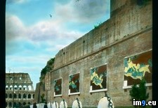
![[Mapporn] Composite map of England in 1900 made with 360 seperate maps. (Extremely high resolution zoomable source in comments, (#High #Source #Map #Extremely #Composite #Zoomable #Seperate) - 4.3 MB Tags: composite, england, extremely, high, map, maps, resolution, seperate, source, zoomable (Pict. in My r/MAPS favs)](https://t.im9.eu/mapporn-composite-map-of-england-in-1900-made-with-360-seperate-maps-extremely-high-resolution-zoomable-source-in-comments-also-versions-for-germany-in-1893-france-in-1750-london-in-1896-and-england-in-1947-in-comments-5786x6600.jpg) Pict. Rome. Basilica of Maxentius and Constantine (Basilica Nova) - north side, with maps of the Roman Empire (1919-1938).3208 (#North #Rome #Maps #Basilica #Constantine #Maxentius)Pict. 799×748 px
Pict. Rome. Basilica of Maxentius and Constantine (Basilica Nova) - north side, with maps of the Roman Empire (1919-1938).3208 (#North #Rome #Maps #Basilica #Constantine #Maxentius)Pict. 799×748 px★ 11k pkt. ♥ 0 gefällt ⬇ 6 gespeichert
 Pict. [Mapporn] Maps illustrating the difference between provinces in Canada (--r-montreal) [529x14519] (#Canada #Maps #Difference #Provinces #Montreal #Illustrating)Pict. 529×14519 px
★ 6184 pkt. ♥ 0 gefällt ⬇ 13 gespeichert
![[Mapporn] Maps illustrating the difference between provinces in Canada (--r-montreal) [529x14519] (#Canada #Maps #Difference #Provinces #Montreal #Illustrating) - 1.1 MB Tags: canada, difference, illustrating, maps, montreal, provinces (Pict. in My r/MAPS favs)](https://t.im9.eu/mapporn-maps-illustrating-the-difference-between-provinces-in-canada-r-montreal-529x14519.jpg) Pict. [Mapporn] Two maps: [left] Results of the 1918 General Election which led to the Irish War of Independence, [right] the modern U (#Two #General #Left #War #Irish #Led #Independence)Pict. 1860×996 px
Pict. [Mapporn] Two maps: [left] Results of the 1918 General Election which led to the Irish War of Independence, [right] the modern U (#Two #General #Left #War #Irish #Led #Independence)Pict. 1860×996 px★ 7867 pkt. ♥ 0 gefällt ⬇ 8 gespeichert
![[Mapporn] Two maps: [left] Results of the 1918 General Election which led to the Irish War of Independence, [right] the modern U (#Two #General #Left #War #Irish #Led #Independence) - 245 KB Tags: election, general, independence, irish, led, left, maps, modern, results, two, war (Pict. in My r/MAPS favs)](https://t.im9.eu/mapporn-two-maps-left-results-of-the-1918-general-election-which-led-to-the-irish-war-of-independence-right-the-modern-uk-ireland-border-1860x996.jpg) Pict. [Mapporn] Updated Google Maps Middle Earth [3600x2700] (#Updated #Earth #Google #Maps)Pict. 3600×2700 px
Pict. [Mapporn] Updated Google Maps Middle Earth [3600x2700] (#Updated #Earth #Google #Maps)Pict. 3600×2700 px★ 4884 pkt. ♥ 0 gefällt ⬇ 3 gespeichert
![[Mapporn] Updated Google Maps Middle Earth [3600x2700] (#Updated #Earth #Google #Maps) - 780 KB Tags: earth, google, maps, updated (Pict. in My r/MAPS favs)](https://t.im9.eu/mapporn-updated-google-maps-middle-earth-3600x2700.jpg) Pict. [Mildlyinteresting] While looking for directions on Maps, I found this movie poster. (#For #Movie #Poster #Maps #Directions)Pict. 576×1023 px
Pict. [Mildlyinteresting] While looking for directions on Maps, I found this movie poster. (#For #Movie #Poster #Maps #Directions)Pict. 576×1023 px★ -11455 pkt. ♥ 0 gefällt ⬇ 8 gespeichert
![[Mildlyinteresting] While looking for directions on Maps, I found this movie poster. (#For #Movie #Poster #Maps #Directions) - 130 KB Tags: directions, for, maps, movie, poster (Pict. in My r/MILDLYINTERESTING favs)](https://t.im9.eu/mildlyinteresting-while-looking-for-directions-on-maps-i-found-this-movie-poster.jpg) Pict. [Mapporn] 9 maps showing the largest ethnicities in the United States by home address [2,997x1,688] (#Showing #States #United #997x1 #Ethnicities)Pict. 2997×1688 px
Pict. [Mapporn] 9 maps showing the largest ethnicities in the United States by home address [2,997x1,688] (#Showing #States #United #997x1 #Ethnicities)Pict. 2997×1688 px★ 6741 pkt. ♥ 0 gefällt ⬇ 6 gespeichert
![[Mapporn] 9 maps showing the largest ethnicities in the United States by home address [2,997x1,688] (#Showing #States #United #997x1 #Ethnicities) - 882 KB Tags: 997x1, address, ethnicities, largest, maps, showing, states, united (Pict. in My r/MAPS favs)](https://t.im9.eu/mapporn-9-maps-showing-the-largest-ethnicities-in-the-united-states-by-home-address-2-997x1-688.jpg) Pict. [Gaming] Ever since Modern Warfare 2, no Call of Duty have came close to having as many enjoyable maps(DLC included). In my hone (#Gaming #Duty #Included #Dlc #Warfare #Enjoyable #Hone)Pict. 600×302 px
Pict. [Gaming] Ever since Modern Warfare 2, no Call of Duty have came close to having as many enjoyable maps(DLC included). In my hone (#Gaming #Duty #Included #Dlc #Warfare #Enjoyable #Hone)Pict. 600×302 px★ -514 pkt. ♥ 0 gefällt ⬇ 1 gespeichert
![[Gaming] Ever since Modern Warfare 2, no Call of Duty have came close to having as many enjoyable maps(DLC included). In my hone (#Gaming #Duty #Included #Dlc #Warfare #Enjoyable #Hone) - 34 KB Tags: call, dlc, duty, enjoyable, gaming, hone, included, maps, modern, warfare (Pict. in My r/GAMING favs)](https://t.im9.eu/gaming-ever-since-modern-warfare-2-no-call-of-duty-have-came-close-to-having-as-many-enjoyable-maps-dlc-included-in-my-honest-opinion.jpg) Pict. meanwhile in maps ( #Maps)Pict. 1098×611 px
Pict. meanwhile in maps ( #Maps)Pict. 1098×611 px★ -3079 pkt. ♥ 0 gefällt ⬇ 0 gespeichert
